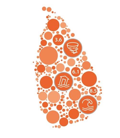

Sri Lanka has an overall risk index of 3.7. The country’s most common disaster events of tsunamis (8.5), floods (6.1), and tropical cyclones (3.6).
Sri Lanka is a teardrop-shaped island located in the Indian Ocean. Approximately half 21.49 million total population live along the 1,340 kilometers (km) of the country’s coastline. The population has become more vulnerable with increasing frequencies of cyclones and monsoonal rains that lead to flooding and landslides.
Although the climate is tropical and monsoonal, it varies from warm coastal plains and lowlands to temperate climates in the hills and mountain regions. The average annual temperature remains consistent at around 27° Celsius (C) with only a rainy or dry season. The rainfall ranges from 1,300 millimeters (mm) in the lowlands of the northeast to anywhere from 630 to 1,900 mm in the hilly regions of the southwest. The southwestern parts of the country can receive up to 5,000 mm of rainfall per year.
Sri Lanka is primarily lowlands with five-sixth of the landmass less than 300 meters (m) above sea level. Although the coastal plains have a mountainous section in the south, east, and west, the most elevated parts of the country in located in the south-central part with rough plateaus cut by a range of mountains. The highest peak of this mountain range is Pidurutalagala at 2,524 m.